What is El Niño?
The El Niño Southern Oscillation (ENSO) is a cycle of warming and cooling events that happens along the equator in the Pacific Ocean.
El Niño is the warming part of the cycle. It happens when there is a decrease in cool waters rising to the sea surface near South America. This leads to an increase in sea surface temperatures across the Pacific, which then warms the atmosphere above it.
The cooling part of the cycle is called La Niña and has the opposite effect.
El Niño and La Niña events happen every two to seven years. They usually last for 9-12 months but have been known to last for several years at a time.
How does El Niño affect weather around the world?
El Niño and La Niña change the way that air and moisture move around the world, which can affect rainfall and temperature patterns globally.
The World Meteorological Organization (WMO) recently announced that El Niño conditions have developed, and that we can expect disruptive weather and climate patterns and a rise in global temperatures.
We know from past events when and which areas of the world are more likely to be wetter and drier during El Niño and La Niña. But no two El Niño and La Niña events are the same, so it’s important to keep track of forecasts as they develop.
Is climate change affecting El Niño?
In general, climate change is leading to warmer sea surface temperatures, and there is some evidence to suggest that this is affecting how El Niño and La Niña events influence weather patterns around the world.
The WMO predicts that global temperatures are likely to surge to record levels in the next five years due to a combination of climate change and El Niño.
Will El Niño cause more disasters?
El Niño events bring different disaster risks to different parts of the world.
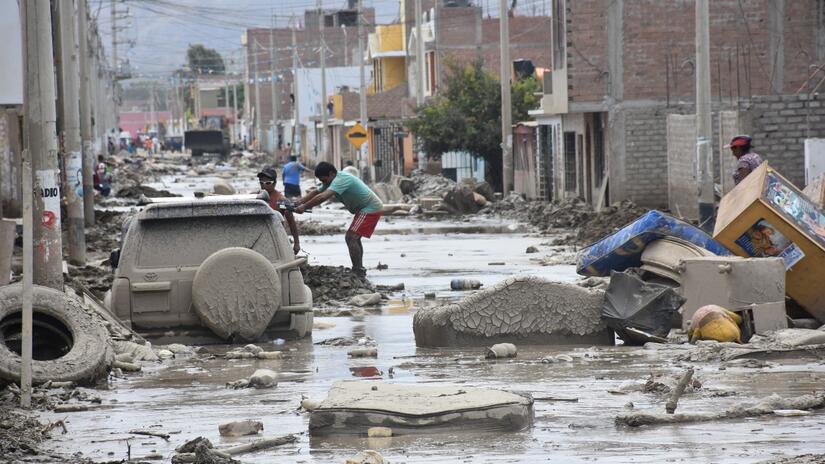
They can cause severe drought in Australia, Indonesia, parts of southern Asia, Central America and northern South America. When the last El Niño occurred seven years ago, it contributed to drought and food insecurity that affected tens of millions of people across southern and eastern Africa.
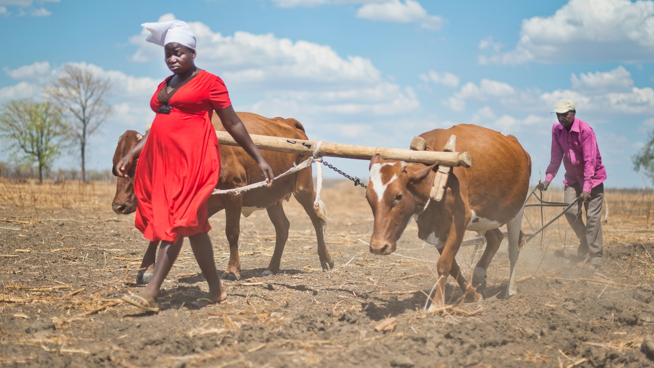
Soloman and Tarisai from Zimbabwe plough their field as the impact of a severe El Niño-induced drought drastically affects farming families in 2016.
Photo: IFRC/Victor Lacken
They can also cause increased rainfall in southern South America, the southern United States, the Horn of Africa and central Asia.
During summer in the northern hemisphere, El Niño’s warm waters can result in more intense tropical cyclones in the western Pacific, but fewer Atlantic hurricanes.
Hear from Lilian Ayala Luque, Senior Officer for Anticipatory Action and Community Resilience for IFRC Americas, about the arrival of El Niño conditions and what it might mean for the region:
What might be different about this year’s El Niño event?
We are already aware of certain factors that will influence how the impacts of this El Niño will affect communities. For example:
- While there is an expectation of an end to the drought in the Horn of Africa, it can take some time for rain to filter down into the soil to support deep-rooted plants and begin restoring agriculture.
- While El Niño conditions usually limit the growth of tropical cyclones in the North Atlantic, this effect may be balanced out by the unusually high sea surface temperatures currently being observed in the region where these storms form.
- In Ecuador and Peru, an outbreak of dengue following flooding earlier this year could potentially be exacerbated by the expected El Niño rains in early 2024. In southern Africa, it remains to be seen whether the cholera situation will be improved by the anticipated drier conditions.
How is the IFRC network preparing for El Niño?
The IFRC network is developing Early Action Protocols (EAPs)– formal plans that outline the triggers and early actions we’ll take when a specific hazard is forecasted to impact communities– including to prepare for hazards related to El Niño.
In Ecuador, for example, we’ve developed triggers to address the increased likelihood of flooding in the rainy season from January to April. And in Central America, EAPs cover the increased likelihood of drought from June to August.
Early actions include things like reinforcing buildings and homes, planning evacuation routes or pre-positioning stocks of food and water.
Where can I find more information?
- Our Early Warning, Early Action page
- Red Cross Red Crescent Climate Centre website
- Anticipation Hub website
- Anticipatory Pillar of the IFRC’s Disaster Response Emergency Fund
- Twitter Space series on El Niño from the IFRC Americas team
--
This article was adapted from a blog post on the Anticipation Hub website co-authored, by Liz Stephens, Andrew Krucziewicz and Chris Jack from the Red Cross Red Crescent Climate Centre. Check out the blog post for more information about El Niño and anticipatory action.